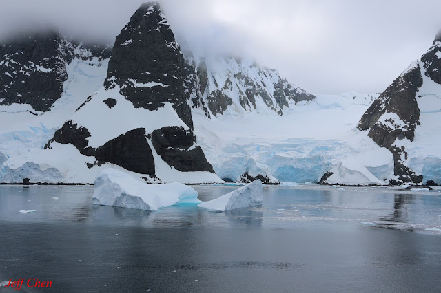
Lemaire Channel (1 of 3), Antarctica
(南極--利馬海峽)
**The
article is part of 25 days trip in South America and
Antarctica, including 21 days onboard cruiser Zaandam
Lemaire Channel -- (65°04'S 63°57'W) (-65.066666,
-63.950000)
Lemaire Channel is a strait off
Antarctica, between Kiev Peninsula in the mainland's Graham Land and Booth Island Antarctica
and nicknamed "Kodak Gap" by some. Steep cliffs hem in the iceberg-filled
passage, which is 11 km long and just 1,600
m wide at its narrowest point.
It was first seen by the German expedition
of 1873-74, but not traversed. Until December 1898, the channel was first
navigated by the Belgian expedition leader Adrien de Gerlache and named after a
Belgian explorer of the Congo Antarctica .
**這篇部落格是25天南美洲及南極旅遊的部份內容(其中包含21天Zaandam尚丹號遊輪行程)
利馬海峽座標-- (65°04'S
63°57'W) (-65.066666, -63.950000)
利馬海峽(Lemaire Channel)是南極大陸Danco Coast西側的一處海峽,位於Kiev半島(Kiev Peninsula)和Booth島(Booth Island)之間,北起雷納岬(Cape Renard),南至克魯斯岬(Cape Cloos),全長約11km,最狹窄處寬不到


沒有留言:
張貼留言